
Search Plainsboro Streets by Address
A Plainsboro Township street directory should begin with the physical address, not an assumed household. First confirm the street spelling and township context. Next use the official property layer for a dated owner and block/lot. The County Clerk deed index can connect that parcel or party to a recorded instrument. The county GIS open-data portal and municipal zoning map provide map context, although research did not locate a dedicated official public owner-parcel viewer with a complete field list. Finally, a historical criss-cross directory can offer an address-first lead for an earlier year.
This sequence separates the three roles that are often confused. A tax owner is an assessment role. A grantor or grantee is a party to a land transaction. A directory listing is a time-bound publication entry. None of those roles proves that a person still occupies the address. Preserve the source date and exact field label before comparing the next record.
- Verify the full address and road spelling on the municipal street or zoning map.
- Use New Jersey Property Explorer to record the displayed owner, block/lot, tax year, and situs.
- Search the Middlesex County Clerk index by party, Town, Lot/Block, or legal field.
- Use available map layers for parcel geometry and road context, not an unverified owner list.
- For a former address, request or inspect the relevant criss-cross or directory volume at Princeton Public Library.
Plainsboro Street and Mailing Lines
Every street search has two address identities. The situs is the physical location on a tax parcel, deed description, permit, zoning map, or GIS feature. The mailing address is the postal delivery label. A mailing line can use a neighboring post office, another city name, a PO Box, or a ZIP that does not match a township boundary. USPS says ZIP codes do not follow municipal lines. A mail line reading Princeton, New Jersey cannot by itself prove that a parcel is in Princeton or that a person resides there.
The Plainsboro zoning and street index map supplies legal township context near South Brunswick, Princeton, and Cranbury. Map labels include Plainsboro Road, Dey Road, Schalks Road, Mapleton Road, College Road, Parker Road, Friendship Road, Gulick Lane, Sayre Drive, Campus Road, and many courts. Older records can abbreviate a suffix or preserve another place name. Keep the original spelling beside the standardized postal address rather than silently replacing one with the other.
- Parcel
- A legally described land unit used by the tax and land-record systems.
- Situs address
- The physical location attached to a parcel or local record.
- Plat or map
- A recorded or official map that locates land, roads, or boundaries.
- Criss-cross directory
- An address-organized directory used to form a historical household lead.
Plainsboro Property Explorer Fields
The New Jersey YourMoney Property Explorer is the reliable official starting screen for a modern Plainsboro address. State documentation describes location and owner, block/lot, annual assessed land value, annual assessed building value, prior-year taxes, and property classification. It is an annual certified-tax-list snapshot. Post-certification changes can be absent. The Plainsboro Tax Assessor at 641 Plainsboro Road maintains tax maps and assessment administration, but no direct online owner-name form was located on the inspected municipal page.
| Interface field | How it helps a street directory search | Research limit |
|---|---|---|
| Location or map control | Places the address in parcel context | Live map controls are dynamic |
| Owner | Shows the assessment owner label | Not a current-occupant finding |
| Block/Lot | Links tax and land research | Use portal labels as displayed |
| Assessment layers | Preserve annual land, building, tax, and class fields | Not a full history series |
The property explorer screen shows the state map-and-layer approach.
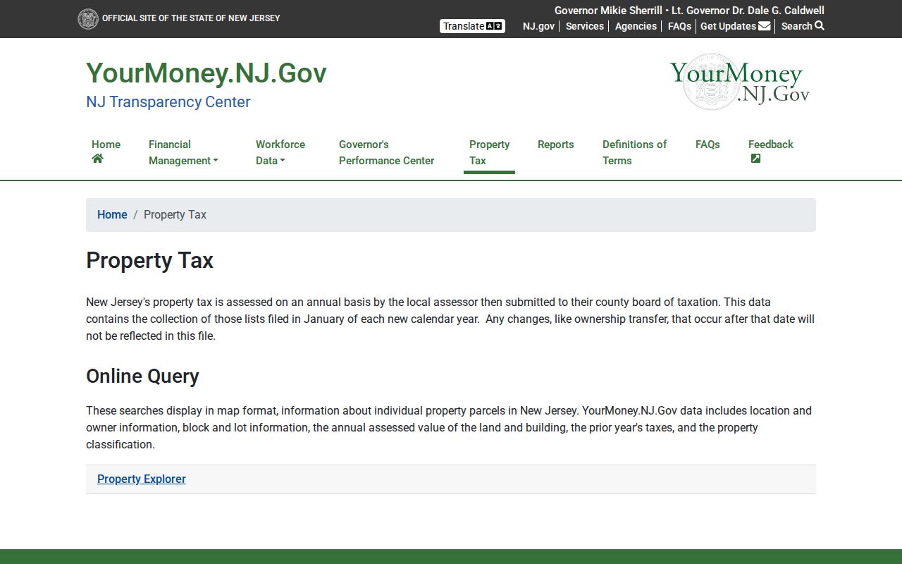
It supports an address trail when paired with a source date. It does not provide a confirmed list of people living on a street.
Plainsboro Deed Search by Street
The Middlesex County Clerk land-record index adds the recorded-transaction layer. Search can be narrowed by Party Name, Town, document type, date range, instrument number, Book/Page, Lot/Block, Map Number, District/Parcel ID, and legal description line. Party Name accepts Last-Name First-Name without a comma. Use the legal or parcel fields when the street number changes or a common surname yields too many results. Index results show a role, document type, instrument number, recording date/time, book/page, consideration, legal lines, and image status where available.
Public online coverage begins with deeds in 1929, mortgages in 1950, and other documents in 1958. A county digitization project reached deed books back to 1923, while older material can require the Registry, State Archives, Rutgers, or FamilySearch. The Registry/Recording Services room is at 75 Bayard Street, fourth floor, New Brunswick, generally Monday through Friday from 8:30 a.m. to 4:10 p.m.; the fee schedule asks visitors to arrive by 4. Public deed copies may be requested in writing or in person.
This Middlesex deed-index screen shows its actual property and party filters.
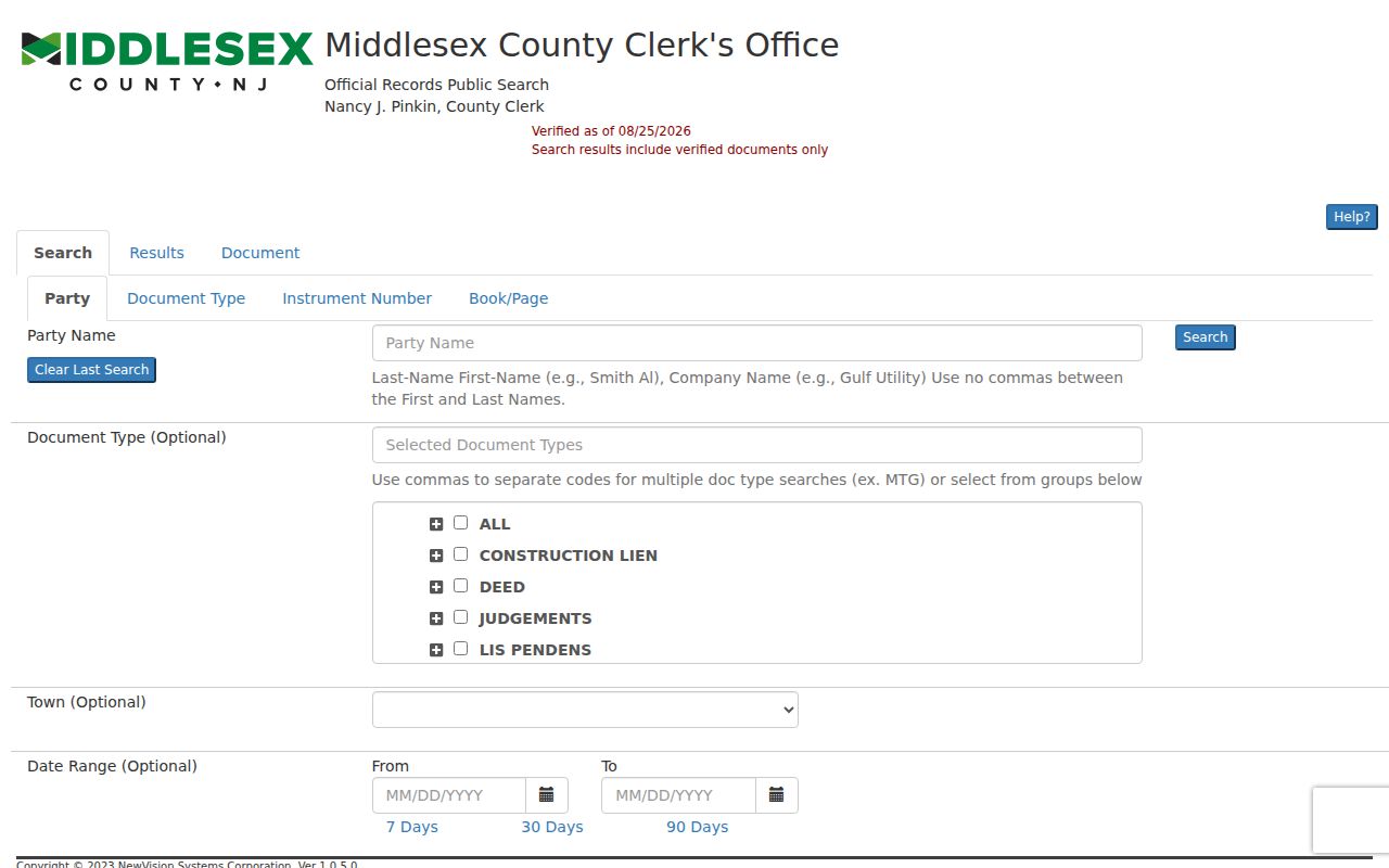
Where an image is restricted, cite the index result and ask the Registry about access. Do not state that an image was read when the system only exposed the index.
Plainsboro Records by Street
Address-keyed sources overlap but do not do the same work. The assessor and property explorer offer an annual parcel snapshot. The Clerk provides recorded instruments. The Building Division and Planning/Zoning routes hold local permit, certificate, and approval material. USPS standardizes delivery information. The election checker is a limited status tool, not an address-by-voter directory. Combining each source only at its stated scope produces a more accurate Plainsboro Township street directory.
| Address record | What it can show | Primary route | Access note |
|---|---|---|---|
| Annual assessment | Owner label, situs, block/lot, assessment fields | State explorer / assessor | Dated snapshot |
| Recorded deed | Grantor, grantee, instrument, legal description | County Clerk index | Images can be restricted |
| Permit or certificate | Address-specific municipal activity | Building Division / SDL | Live fields not inspected |
| Postal result | Standardized delivery line and ZIP+4 | USPS lookup | Does not prove occupancy |
| Existing local record | Named document within a date range | Township Clerk OPRA | Exemptions and redactions apply |
Plainsboro Permit Address Trail
Permits are municipal records, not County Clerk records. Plainsboro’s Building Division enforces the New Jersey Uniform Construction Code and handles construction permits, inspections, certificates of occupancy, temporary certificates, and certificates of approval. Inspections need at least 24 hours’ notice. The Township participates in the SDL Portal for information, status, and requests, but research did not confirm its live field labels, filters, coverage, exports, or login behavior.
For a particular property, request the identified permit, certificate, zoning approval, site-plan file, or date range from the responsible custodian. The Township Clerk’s OPRA instructions require a reasonably clear description and do not require staff to research every property file. A permit applicant, contractor, owner, and occupant are different roles. Use whichever one the record actually displays.
Plainsboro Map Viewer Gap
The Middlesex County GIS Open Data Portal is the official mapping fallback for boundary, transportation, environmental, and related layers. Research did not locate a dedicated official public parcel-owner viewer or a complete public owner-field schema. Treat map polygons, road centerlines, tax maps, and zoning layers as geographic context. They do not make a map-clicked parcel into proof of the social or physical neighbors around it.
For a named road, retain the layer date and distinguish the property boundary from the postal route. When a parcel number or owner field is not visible in the official map, do not replace the gap with an unverified data source. Move to the property explorer, assessor, County Clerk, or a narrow municipal request instead.
Plainsboro Street Postal Checks
Use the USPS ZIP Lookup Tool to standardize a full street address before comparing it with a deed or tax record. By Address asks for a street address and city/state, with optional company, unit, and ZIP fields. It can return the current delivery line and ZIP+4. By City and State, and Cities by ZIP, are broader postal lookups. None of the modes confirms that a named person or company occupies the address. USPS delivery geography and the legal location of a parcel have different purposes.
The verified Plainsboro Post Office ZIP is 08536. Nearby postal localities include Princeton 08540, Cranbury 08512, and Princeton Junction 08550, but research did not establish those as township-wide Plainsboro routes. Test a complete street and unit instead of assuming coverage from a nearby city name. Keep the returned USPS line, the parcel situs, and any mailing line in the record log. When they differ, compare the municipal street map and official parcel context before treating the difference as an error.
A postal correction can be useful evidence about delivery formatting, but it does not change the legal description in a deed or the municipality shown on a parcel record.
Plainsboro Historical Street Names
Plainsboro Township’s formation in 1919 is a central address-history issue. Before incorporation, land north of Plainsboro Road and Dey Road was in South Brunswick and land south was in Cranbury. A historical search on the same modern street can therefore require both earlier names. Test old road spellings, farm names, abbreviated suffixes, former township labels, and county terms. The inspected sources did not establish a street-renumbering project, full readdressing year, or an E911 crosswalk. State that gap plainly rather than inventing a conversion.
The County Clerk’s online dates are another useful boundary. A deed reference that points past the web coverage belongs at the Registry, archive, or older microfilm route. The Being Clause or recital in a deed can cite a predecessor Book/Page. That one citation often supplies a more reliable backward step than a street-name-only search.
Plainsboro Criss-Cross Address Books
Princeton Public Library’s local-history guide identifies Hill-Donnelly and InfoUSA criss-cross directory variants, plus City/Polk directories, phone books, maps, and newspaper resources. Criss-cross books can be arranged by street address or phone number rather than surname. They are especially useful once a land or map record has supplied a stable address. Availability varies by title and many holdings are physical or uncatalogued, so ask the Princeton Room’s second-floor Information Desk for the relevant year.
A listing is a historical lead, not a modern occupancy claim. Record the title, year, page, address form, and any abbreviation. Follow it with a dated deed, tax record, newspaper citation, or archive item. The Plainsboro directory book explains the library’s collection runs and their gaps.
Limits of Plainsboro Street Records
A street directory cannot establish every person who lives along a road. Renters and other household members may not appear in assessment or deed records. A mailing address may differ from the situs. The state voter checker is limited, and voter identity numbers are confidential. DMV address information is restricted. Utilities, library circulation, protected vital records, sealed cases, and Address Confidentiality Program information do not become public because they relate to a street.
Note: USPS can confirm a standardized delivery address and ZIP+4, but it does not confirm that a person or company occupies the address.