
Plainsboro Neighbors by Record Type
There is no official Plainsboro Township roster of neighbors. A useful block search separates a map question from a property question and a community-contact question. The Middlesex County GIS Open Data Portal is the official mapping fallback for roads, boundaries, and available layers. Research did not locate a dedicated official county viewer that publishes a complete parcel-owner search screen. For an assessment-owner snapshot, use the state property explorer. For an earlier transfer, use the Middlesex County Clerk index. Treat each result as evidence of its stated role and date.
| Source | What it shows about a block | Access |
|---|---|---|
| Middlesex County GIS Open Data | Official map and layer context, including streets and boundaries where available | Online mapping fallback; no complete owner viewer located |
| NJ Property Explorer | Annual assessment owner, situs/map context, block/lot, assessment, tax, and classification layers | State online map; a dated tax-list snapshot |
| Middlesex County Clerk land index | Recorded parties, deed details, legal-description fields, and parcel references | Online index plus Registry and certified-copy routes |
| Middlesex Board of Elections | Election-list request process and election resources | Ask the Board for current authorized request, fee, and delivery rules |
| Municipal community-group route | A way for a group to request an officer presentation | Contact form, not a member or household directory |
A named owner, recorded deed party, postal delivery line, and current household are different things. The record should be described with the label that appears on it. That precision matters when nearby parcels have a trust, estate, company, lender, or a separate mailing contact.
Define a Plainsboro Neighbor
For Plainsboro Township neighbor research, define the relationship before opening any record. An adjacent parcel means a parcel touching or immediately abutting the starting parcel on a map. A same-block search is broader and depends on the road pattern. A development, postal route, or named community is broader still. Those categories may overlap, but they do not mean the same thing. A polygon beside another polygon is geographic context, not proof of a social relationship or a current household.
The municipal zoning and street map supplies useful place context. It names Princeton Meadows and Plainsboro Center in local materials and shows the township beside South Brunswick, Princeton, and Cranbury. It also labels roads and zoning districts. Use it to check a road spelling and to understand where a block sits, not to claim that every address in a mapped area belongs to a particular neighborhood association. A mailing city or ZIP can differ from the situs municipality, so USPS delivery data needs its own address-level check.
Map reading tip. Save the map layer and date with each parcel identifier, because a boundary view helps explain location but does not establish a person’s connection to an address.
Plainsboro Neighbor Map Context
Start with the official street and zoning map, then compare its roads with the County GIS catalog. The map makes the jurisdiction edges visible: South Brunswick, Princeton, and Cranbury are nearby labels, while Princeton Meadows and Plainsboro Center are local place names rather than an official resident directory. A pre-1919 historical record can require a former jurisdiction search, but that is a historical-record issue, not a present block boundary.
Postal geography creates a separate layer. USPS says ZIP codes do not follow legal municipal lines, and its result does not confirm that a person or company occupies an address. Preserve the returned postal line and the parcel situs as separate facts. When they disagree, use the municipal street map for township context and the exact USPS result for delivery context. Do not turn a shared postal route into a list of Plainsboro Township neighbors.
Map Plainsboro Neighbor Parcels
Use an address-to-parcel workflow for the immediate block. First locate the road and address in the official map context, then note the starting parcel’s visible block and lot identifiers. Next, record only the adjoining or intended nearby parcel identifiers the map supports. The New Jersey Property Explorer can then supply its annual owner, assessment, tax, and classification fields for a matching parcel. If a recorded transfer needs confirmation, move to the Middlesex County Clerk land-record index with the town, lot/block, party, or legal-description fields that fit the record.
- Confirm the address spelling and township location with the municipal map and, if needed, USPS.
- Use the County GIS open-data context to identify the starting parcel and nearby parcel identifiers visible in official layers.
- Check each identifier in the state property explorer and record the tax year, assessment-owner label, block/lot, and source date.
- Use the County Clerk index only to confirm a recorded-party or deed detail. A restricted image is an access result, not a reason to make an assumption.
- For a whole named street instead of the immediate block, use the Plainsboro Township street directory workflow.
The property explorer does not establish occupancy, and the municipal assessor page did not expose a public owner-name search form. A request for a certified deed or an in-person Registry visit is the next step when an authoritative copy or image is needed. Keep the owner, party, and address roles separate in notes.
See the state property explorer interface before using its assessment layer for Plainsboro Township neighbors.
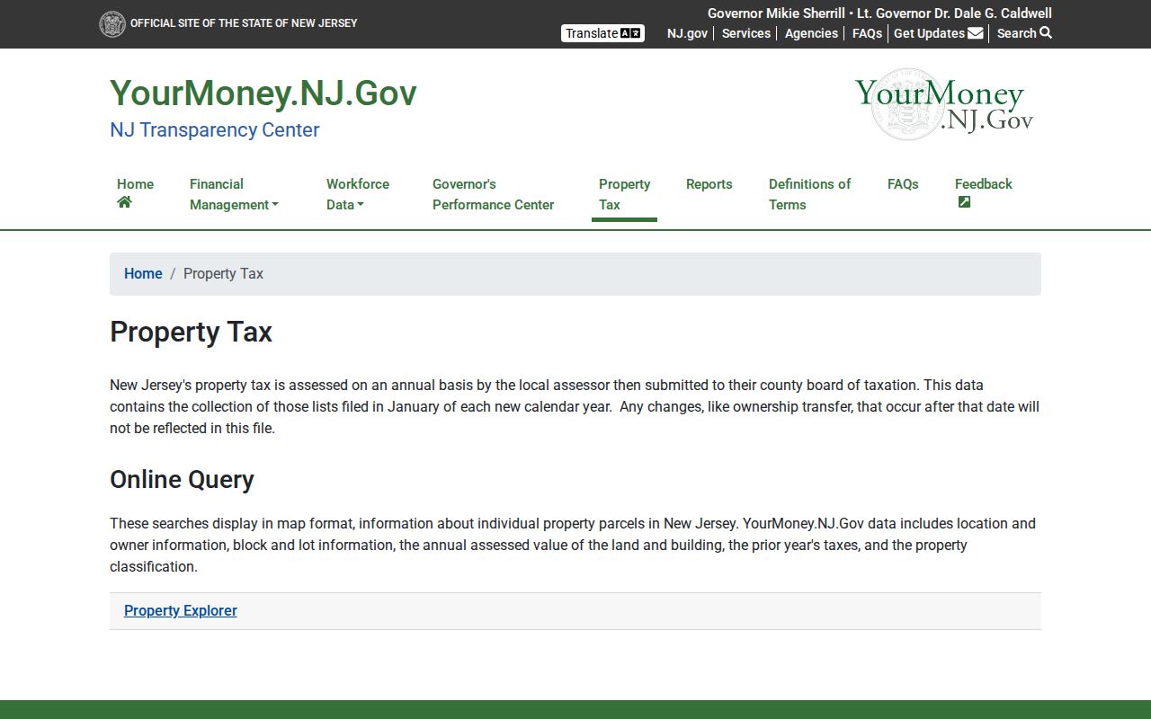
The screen illustrates the map-layer approach. It supports a parcel and assessment check, while the visible owner field remains an assessment label rather than a statement about who lives nearby.
Plainsboro Neighbor Owner Snapshots
The state explorer describes location or situs context, owner, block/lot, annual land and building assessments, prior-year taxes, and property classification. Its tax-list layer is filed annually, so a later change may not appear. That makes it a good way to preserve the wording of a municipal assessment at a particular time, not a replacement for title research or a current address confirmation.
| Field | How to use it for nearby parcels |
|---|---|
| Location or situs | Match the physical parcel and street context. |
| Owner | Describe as the annual assessment owner, not a present household. |
| Block and lot | Carry these identifiers into Clerk or assessor follow-up. |
| Assessment and prior-year tax | Keep the displayed tax-year snapshot and source date. |
| Classification | Use as a property field only, without conclusions about people. |
The Plainsboro Tax Assessor maintains tax maps and sales lists by development or model and can address local assessment administration. The office is at 641 Plainsboro Road and is reachable at 609-799-0909 ext. 1411. Its published municipal page does not provide the missing direct owner lookup. For a record that already exists but is not online, a narrow request to the appropriate custodian should identify the address, date range, and record type.
Plainsboro Neighbor Association Leads
An older Plainsboro Open Space and Recreation Plan is useful for names to verify, not for current membership, officer, or boundary claims. It lists Aspen Homeowners’ Association, Barclay Square at Forrestal, Brittany Homeowners’ Association, The Commons at Princeton Landing, Deer Creek, Fox Run, The Hampshire Associations, Hunters Glen, Pheasant Hollow, and Pond View Homeowners’ Association. The plan is a starting point for checking a group’s own current public contact channel. No comprehensive municipal directory of current association officers, members, or parcel boundaries was located.
| Association or community lead | Plan location lead | Responsible use |
|---|---|---|
| Aspen and Brittany Homeowners’ Associations | Plainsboro Road | Older plan references; verify any present contact independently. |
| Barclay Square at Forrestal | Mapleton Road | Community and amenity lead, not a household list. |
| The Commons at Princeton Landing | Sayre Drive | Older plan lead; no public member roll located. |
| Deer Creek, Fox Run, Hunters Glen, and Pheasant Hollow | Plainsboro Road, Hunters Glen Drive, or Dey Road leads | Complex names require current verification. |
| The Hampshire Associations and Pond View Homeowners’ Association | Scotts Corner Road and Pond View Drive leads | Older names and location leads, not confirmed current boundaries. |
The Plainsboro Police Community Group/Homeowners Association Request asks a group contact for first and last name, phone, community or group name, officer-presentation preference, best day and time, and related contact details. It is a contact route for a group, not a resident directory. It should never be used to seek a membership list.
Use the municipal community-group request form only as the source describes it for Plainsboro Township neighbors.
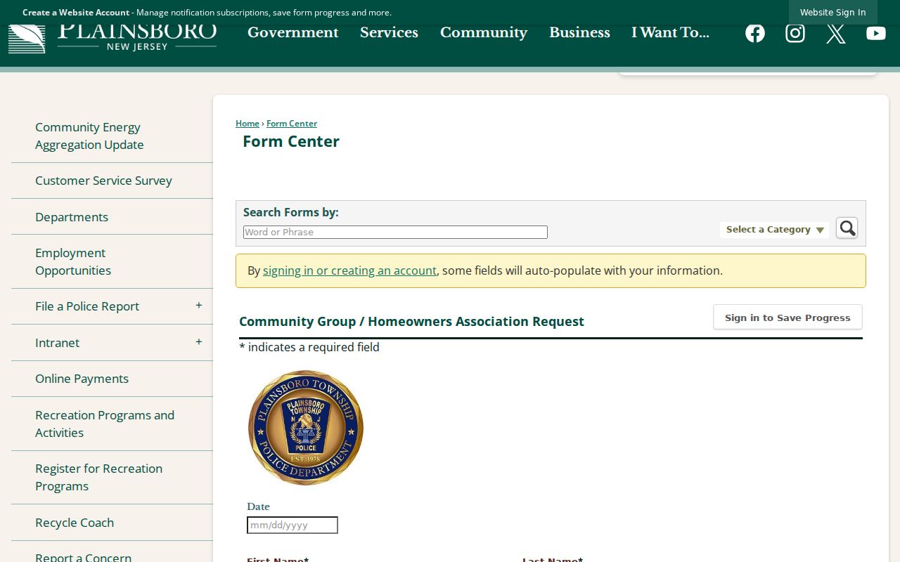
The form shows why it is a contact channel rather than an association roster: it collects a representative’s details and presentation preferences instead of publishing homes, members, or association boundaries.
Plainsboro Neighbors and Voter Limits
New Jersey’s public voter-registration checker is a limited election verification tool, not a block list. The live checker returned a 403 during research, so its current field labels and result schema were not available for confirmation. State guidance indicates that a name must exactly match the county record, but that is not permission to infer a street address, party, birth date, or full registration file from a result.
Ward, district, and municipality-code fields appear in election administration, but the research identifies them as clerk-side fields. A current election-list request goes through the Middlesex Board of Elections and its current request, password, fee, and delivery process. The inspected materials did not establish those terms, so they should be requested from the Board rather than guessed. Election records can document an election process; they do not turn a neighborhood label into a roster.
Note: Record the exact request, source date, and any access limitation, because a blocked portal or a restricted list says nothing reliable about who may live on a Plainsboro block.
Official and Commercial Neighbor Tools
Tools that collect public and commercial data can be broad, but their labels, dates, correction paths, and geographic logic may be unclear. For a nearby-parcel question, the official source is usually narrower and more useful because it makes the record type visible. A commercial category can offer a lead, but it should not replace the assessor, Clerk, map, or election custodian.
| Official record path | Commercial neighbor-tool category | Practical difference |
|---|---|---|
| Map, assessment, deed index, or custodian response | Combined people and address data | Official sources identify the record role and date; compiled results may mix roles and periods. |
| Narrow address or parcel question | Broad names-around-an-address result | The official path can be verified with the responsible office. |
| Published privacy and correction rules | Provider-specific data practices | Protected or redacted data must remain protected. |
When the goal is a community connection, use a group’s public contact path or a public meeting record. When the goal is property history, use the parcel-to-deed chain. Combining every available trace into a profile is neither necessary nor responsible.
Privacy Limits for Plainsboro Neighbors
New Jersey privacy rules set clear stop points. The Address Confidentiality Program can provide a substitute address for qualifying survivors and reproductive-health patients or providers. Daniel’s Law, P.L. 2021, c.371, gives covered people a route to request removal or redaction of specific personal information. A protected or redacted record should be treated as unavailable, not as a lead to reconstruct elsewhere. Vital records, confidential voter ID numbers, library patron records, sealed or expunged files, and protected law-enforcement material have their own limits.
For a municipal record, the Plainsboro Township Clerk is the local custodian under the New Jersey Open Public Records Act, N.J.S.A. 47:1A-1 et seq., as amended by P.L. 2024, c.16. A narrow request can seek an existing, identifiable record, but it cannot require the Township to create a new address-to-person database. Ask for the smallest needed record, date range, and delivery format. Redactions and denials are part of the lawful process.
Use boundaries. Parcel and association research may support civic curiosity, a property question, or reconnecting through a public channel. It may not be used to stalk, harass, intimidate, or harm any person, or to defeat a protection or redaction.